Fewer Repeat Truck Rolls
A path that terrain blocks is visible before the ladder comes off the van, not after an hour on the roof.
Installers stop guessing which tower serves an address. ISPbox ranks the sectors that cover the spot, checks the terrain along the path, and guides the dish onto the correct bearing and tilt.
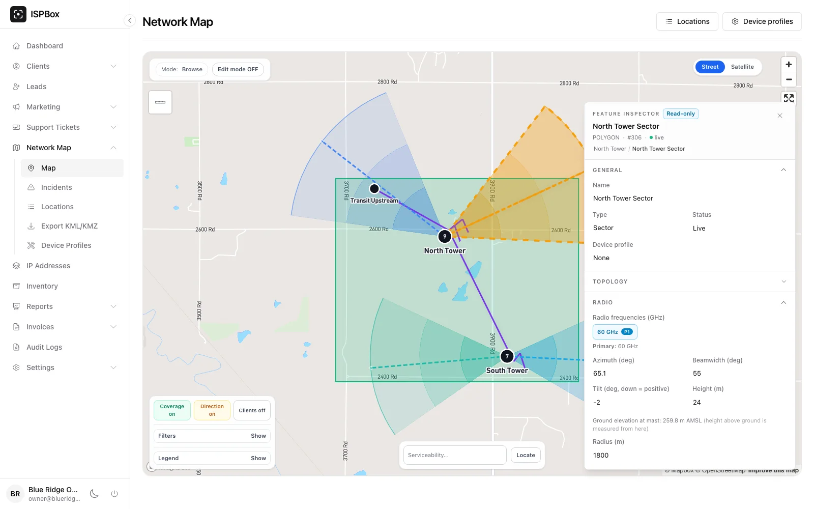
Real screens from the product - the network map your engineers plan on and the field app your installers carry.
Every wireless sector on the map stores azimuth, beamwidth, downtilt, antenna height and range. ISPbox adds the ground elevation under the mast from terrain data, so the height above ground is never confused with height above sea level.

From a GPS fix or the service address, the app ranks sectors that cover the spot first, then the rest by distance. Each row shows the bearing to aim at, the elevation angle and whether the terrain leaves the path clear, blocked or marginal.

The chosen sector, the install coordinates and the CPE antenna height are written straight to the subscriber service, so support and the next technician see which sector the customer is on.

Wireless installs fail for boring reasons: the dish points at the wrong tower, or at the right tower through a ridge. ISPbox turns the sectors you already drew on the network map into an antenna alignment tool your installers carry, with a terrain line of sight check on every candidate path.
Give the app a position - the phone GPS, the saved install coordinates or the client address - and it measures the distance and bearing to every sector mast, compares the direction against each sector azimuth and beamwidth, and checks the configured range. Sectors that cover the spot with a clear path come first, then covering sectors with a marginal path, then anything else by distance. Each row carries the frequency, the mast antenna height and the bearing the CPE should point at.
For each candidate ISPbox samples ground elevation along the great circle path, lifts both ends by the real antenna heights, and applies the standard four thirds earth curvature correction. Where the ground rises into the path the link is reported as blocked; where it stays clear of the ground but eats into 60 percent of the first Fresnel zone it is reported as marginal. The app draws the profile so the installer can see the ridge, with the lowest clearance and where along the path it sits.
The aiming view puts the target bearing and elevation over the phone camera with a compass tape and a tilt bar, and turns green inside the tolerance. It works in two directions: aim a subscriber CPE at a chosen sector, or stand on the mast and set a sector antenna or a point to point dish to its planned azimuth and downtilt. Phone compasses drift near metal, so the screen shows the compass accuracy and the reading stays a starting point that signal readings confirm.
Works with Network Maps, Network Monitoring, Mobile Apps
A path that terrain blocks is visible before the ladder comes off the van, not after an hour on the roof.
The bearing, tilt and sector choice come from your own network data, so a new installer works like your best one.
Every install writes back the sector and antenna height, so the map keeps matching what is on the roof.
When a subscriber drops out, support already knows the sector, the distance and the clearance on that path.
ISP mapping the way operators need it: build your network map on an interactive Mapbox view, place towers, OLTs, splitters, ONTs and fiber, coax and wireless links as real geographic features, trace PON optical budget, and export to KML.
Learn moreMonitor your ISP network in real time: ISPbox pings every router each minute, tracks PPPoE and DHCP client sessions, and fires alerts to Discord, Slack, email or webhooks with flap damping so you hear about real outages fast.
Learn moreISPbox path monitoring measures latency and packet loss to every device on your network map like SmokePing, then works out which link is at fault, explains why, and opens an incident for the customers behind it.
Learn moreHow-to guides: Finding the Right Sector and Aiming the Antenna
Free tools for this: Link Budget Calculator, dBm to Watt Converter
Start with ISPbox and give your field team the map, the line of sight check and the aim in one app.